Sustainable Cities Design Academy 14 : Recap
AAF’s Center for Design & the City held its 14th Sustainable Cities Design Academy June 10 – 12 in Washington DC. There, teams from Chicago, IL, Kansas City, MO, New Brunswick, NJ, and Pittsburgh, PA collaborated with a team of multi-disciplinary designers in a 2.5 day charrette to design charrette to evaluate their projects, learn about relevant practices, and strengthen their capacity-building networks.
SCDA prioritizes collaboration and information exchange between project teams and resource teams. Project teams have the opportunity to work directly with the nation’s top architects, environmental designers, landscape architects, planners, real estate developers, industrial economic development specialists, and urban designers. This dedicated space allows them to learn about best practices in urban design, place-making, phased financing, and authentic community engagement practices as they co-create solutions to their projects’ challenges.
Chicago’s Englewood Square Corridor

The intersection of 63th and Halsted in Chicago’s Englewood neighborhood. Image courtesy of Wikipedia: MrHarman.
Ernest Brown of Brown & Momen, Monica Chadha of Civic Projects, Glen Fulton of the Greater Englewood Community Development Corporation, and Michael Newman of SHED 5tudio comprise the Englewood team. The Englewood community has endured low employment and low economic growth for many years, and as a result, its population has dwindled by 11% since 2000. The Englewood Square Corridor plan outlines a long-term solution to revitalize the community, which includes building a Whole Foods Market, a food/retail district, a GECDC business accelerator and incubator, and a mixed-use space.
At SCDA, they worked with resource team members Sustainable Community Development Group‘s Deeohn Ferris, PolicyLink‘s Anita Hairston, and WRT’s Nando Micale to research the feasibility of mixed-use retail and commercial development at the intersection of 63rd and Halsted. They also explored adding infill development and complete streets improvements north to north and east of the initial project site.

The Chicago project and resource team explore options to best develop Englewood’s 63rd and Halsted.
Priority action items to drive their project going forward emerged from their collaboration with the resource team: creating leasing spaces for local businesses; places for residents, shoppers, and Kennedy King Community College students to congregate and enjoy programmed neighborhood activities; and thoroughfares for pedestrians and cyclists to feel welcome. They also identified the need to better connect neighborhood institutions when planning and implementing next steps.
Kansas City’s Municipal Farms Sustainable Reuse Site

The Brush Creek/ Blue River Confluence is located on a parcel of land at Municipal Farm. Image courtesy of Kansas City, MO.
Andrew Bracker and Gerald Williams of the City of Kansas City, MO, Scott Schulte of the Heartland Conservation Alliance, and John Gordon Jr. of Boys Grow comprise the Kansas City team. The Municipal Farms Sustainable Reuse Site team aims to transform Municipal Farm, a 440-acre site owned by the city, into 21st century sustainable, urban agricultural and multi-use campus. The Sustainable Reuse Plan for Municipal Farm includes walking and recreation trails that connect residents to nearby neighborhoods, links to a planned regional commuter rail line and a rails-to-trails system, renewable energy projects, development of a city-owned green infrastructure maintenance and training facility, and creation of outdoor learning spaces.

The Kansas City, MO team discusses the best use of a contaminated parcel of land on Municipal Farm during the charrette.
During SCDA, the Kansas City project team collaborated with resource team members AECOM‘s Garrett Avery, New Territories’ Christina Grace and SWA Group‘s Joe Runco to reorient their master plan approach to better connect the site. They realized that they could unite the two halves of this large site with an iconic bridge running east-west over IH-495, and conceptualized a thoroughfare that would draw interest and attention to the overlooked acreage as well as the new uses on the site that include urban agriculture (growing -production) and community recreation uses. The team also developed a phased strategy for rehabilitating contaminated areas within the site.
New Brunswick’s Rail/Arts/River Project

The Raritan River is an integral component of New Brunswick’s Rail/Arts/River project. Image courtesy of AAF.
New Brunswick’s team, composed of Heather Fenyk of the Lower Raritan Watershed Partnership, Dan Swern and John Keller of coLAB Arts, and Tobiah Horton of Rutgers University will explore their Rail/Arts/River project. The Rail/Arts/River project intends to use visual art and sustainable design as a way to connect the city’s riverfront and railway transit station. Key to the project is several different zones connecting the New Brunswick train station, Raritan River, Lord Stirling Elementary School, and the central business corridor. The team plans for community members to explore these zones, which span two miles, by foot.
The New Brunswick team worked with resource team members SH!FT Design Studio‘s Jane Martin and Jason Bregman of Michael Singer Studios. During the charrette, they developed a plan to redesign the Raritan Riverfront park space, which is prone to heavy flooding and subsequent damage. This redesign would accommodate extreme weather changes and create a scheme where the park could be “given back” to the river. This feature became a main organizing point for the team’s planning of the remainder of the proposed way-finding / public art / environmental education initiative from NJ Transit / Amtrak Station to the Raritan.

The New Brunswick team outlines how to redesign the Raritan River parking area to alleviate flooding and provide a commons space for the community.
Additionally, they examined ways to demonstrate water-related cleaning, harvesting, and reusing demonstration projects that could be included as part of public art features along the suggested route. These environmental learning stations could add high visual value to their neighborhood context while serving a functional and necessary water management activity.
Pittsburgh’s Strip District Riverfront Park Project

The Pittsburgh team proposes a 20-block riverfront park in the Strip District along the Allegheny River. Image courtesy of Wikipedia: phillipq23.
The Pittsburgh Strip District team, composed of Riverlife’s Addy Smith-Reiman, Oxford Development Company’s Michael Bernard, Friends of the Riverfront’s Jeff McCauley, Wigle Whiskey’s Eric Meyer, and Katherine Camp of the Pittsburgh Water and Sewer Authority, propose a new 20-block riverfront park concept for the Allegheny Riverfront in Pittsburgh’s Strip District neighborhood. Their vision for the park will provide the Pittsburgh community with much-needed green space for recreation and relaxation. Upon completion, the park will be equipped with storm water management solutions, riverbank stabilization, restored habitat/riparian ecology, and a continuous bike/pedestrian pathway to connect residents to downtown Pittsburgh.
The Pittsburgh project team worked with resource team members Lesley Bain of Framework Cultural Placemaking, Josh Nims of the Schuylkill River Development Corporation, and Dan Melman and Michael Stevens of Capitol Riverfront BID to evaluate the programming and maintenance challenges that faced this in-concept amenity. They recognized that several underused adjacent parcels could contribute as gateways to the Strip District residential and commercial neighborhood and the trail system. To provide proof of concept for more permanent design solutions that would contribute to the functionality and vibrancy of this area, the team could test and monitor temporary interactive demonstration projects, including those that contribute to riverbank stabilization, stormwater management, and extension of the trail system into the neighborhood.

The Pittsburgh team explores how to use cisterns underneath the riverfront trails as a stormwater management strategy.
Participants at SCDA also established a wider social network of support, learning, and leadership from which to draw when faced with opportunities to design better places. Recent SCDA alum Tom Phillips, Executive Director of Capital Workforce Partners, said of his experience, “[SCDA] provides a broader perspective on how to better align more strategically ‘bricks and mortar’ with human capital development. I hadn’t realized that design can have a greater impact on community development and be a catalyst for meaningful change.“
To learn more about the upcoming session or to learn more information on the Sustainable Cities Design Academy, contact Center for Design and the City Director Elizabeth Okeke-Von Batten at [email protected].
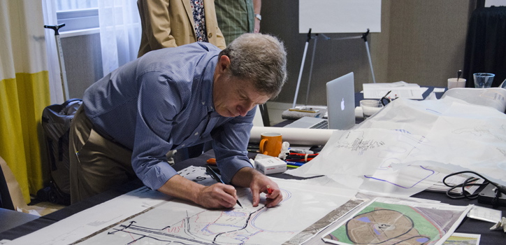
Featured image courtesy of the American Architectural Foundation.